.jpg)
Starling
Allows you to monitor your environmental impact with reliable forest cover change analytics that detect deforestation. It uses a combination of optical and radar satellites, such as Copernicus Sentinel as well as Airbus’ SPOT satellite imagery, offering large coverage at 1.5m resolution.
What’s in Starling?
- Basemap
The Basemap depicts a natural forest and the main landscape features over 20-year time series. This allows you to focus on areas that matter the most for you to drive and follow-up actions to achieve impact.
- Monitoring
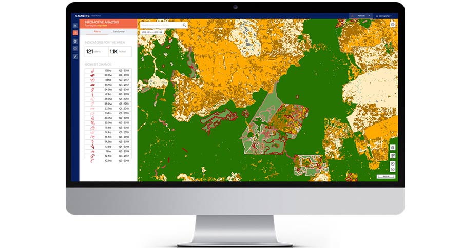
The Monitoring identifies forest cover change and raises alerts every quarter and provides an overview of the size and the dynamics of deforestation.
- Online Dashboard
The Dashboard gives you access to key analytics to determine priority areas where to take action, even over vast supply sheds.
Key features
- Best accuracy- In-house algorithms with unrivaled accuracy detect deforestation and guarantee quality.
- Fit for action- Customised dashboard with a full overview of deforestation alerts, meaningful analytics, and evidence-based reporting.
- Global monitoring- Worldwide coverage with already 7 million square km of land mapped out covering close to 100% of production areas, and main production regions, as well as large portions of productive forests globally, from tropics up to boreal areas.
- Easy-to-use- Digital and intuitive platform with numerous interactive features and downloadable reports.