UTILITIES AND COMMUNICATION
- Link Profile Analysis
- Mapping
- Mass Link Profile
- Network Planning and analysis
- RF Viewshed
- Viewshed Analaysis
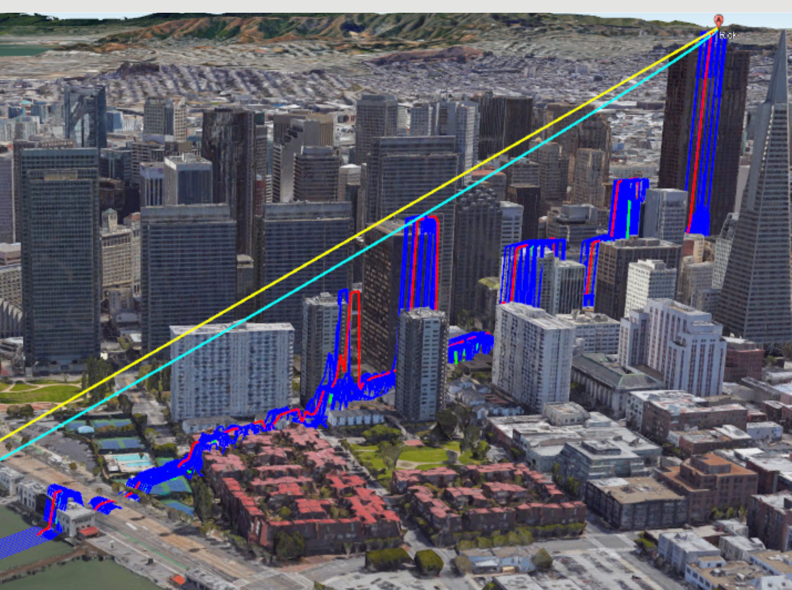
Try our data and analytics for network planning and instant access to powerful analytics for line-of-sight simulations with highly accurate terrain data.
Partners: Airbus, Intermap, and Hexagon Safety, Infrastructure and Geospatial, Leica Geosystems Airborne sensors
Featured Partners: Airbus, Intermap, and Hexagon Geospatial, Leica Geosystems

Powerful, easy to use geospatial solutions for Utilities and Communication


.png)