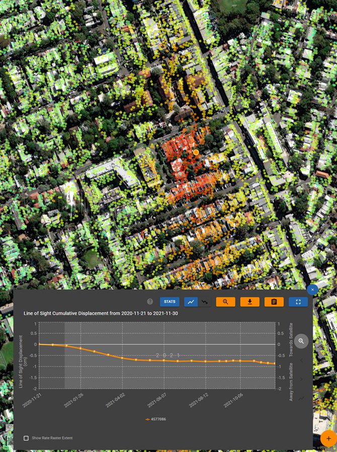
Historical Analysis
Radar satellites have been collecting images around the globe since the early 1990’s.
- Understand historical slope movement or infrastructure displacement
- Develop baselines for contemporary data or applications
- Locate areas of stability for planning of new development projects
- Cost-effective